
Durango Bill's
Pictures of the Animas River Flood
May 23, 2005
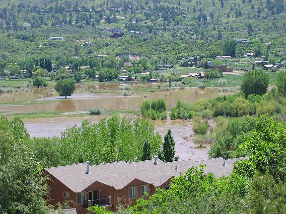
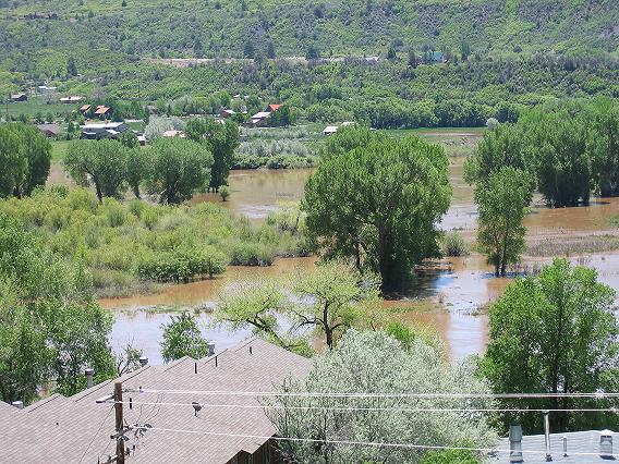
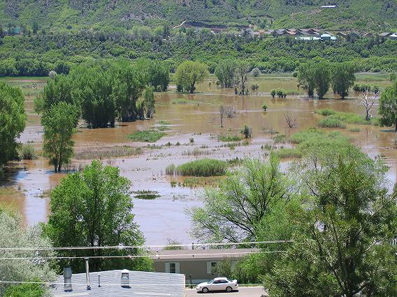
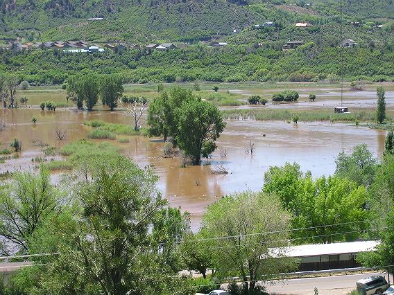
The area to the north of Durango is a classic “flood plain”. During the most recent ice age, glaciers scoured out a lake several miles long just north of the city. Several “terminal moraines” were left across the north edge of town. When the glacier melted, the former lake was filled in with sand and gravel, leaving a broad nearly flat surface. The flat valley bottom has become a prime ranching/farming area, but it remains only slightly above normal river levels. When high water comes down the Animas River, it is free to spread significant distances across this flood plain.
The winter of 2004/2005 produced a much above normal snow-pack in the Animas River headwaters in the San Juan Mountains. Early spring weather was cool, and then, above normal temperatures resulted in sudden melting of the snow-pack. Over a period of 10 days the Animas River in Durango rose to near flood stage.
The pictures below were taken about noon on May 23, 2005. River flow was about 8,400 cubic feet per second (revised upward from the original report of 8,000 cfs)) with a river gauge height at about 7.37 feet. The extreme crest came on 5/25/05 at 7.4 feet and 8,500 cubic feet per second. Flood stage is defined at 7.5 feet. Data is from USGS River Station # 09361500. http://waterdata.usgs.gov/co/nwis/uv?09361500
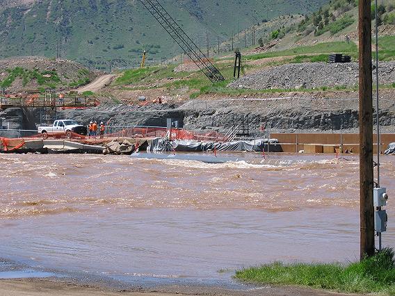
The first picture
shows construction for the pumping station for the Animas – La
Plata Water Storage Project. The lowest barrier next to the
river is completely submerged, and the construction workers
and pickup truck are on the main temporary dam. The main dam
itself had been built up over a foot in the preceding 24
hours. The right hand portion of the picture shows plywood,
sandbags, and tarps that have been thrown in place on short
notice just to keep the river out.
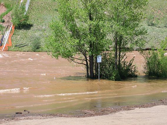
The above picture shows part of the lower parking lot at Santa Rita Park, which is just south of the main part of Durango. The park is very popular in the summertime, but during the May flood, parking spaces were somewhat limited.
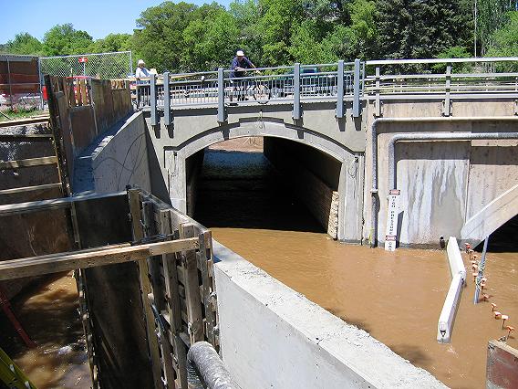
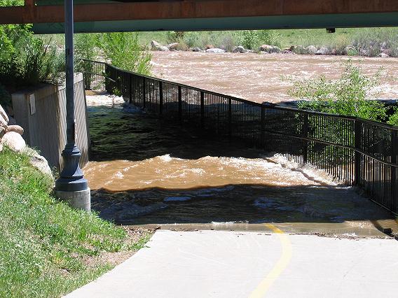
On the north end of town, the Main Ave. bridge (U.S. Route 550) across the Animas River has been lengthened so that pedestrians using the Animas River Trail can cross under the traffic instead of trying to dodge traffic. A new tunnel has been constructed for the Animas River Trail. The trail hadn’t been finished yet as of May 23, 2005, but even so, it could only have been used by kayakers instead of hikers.
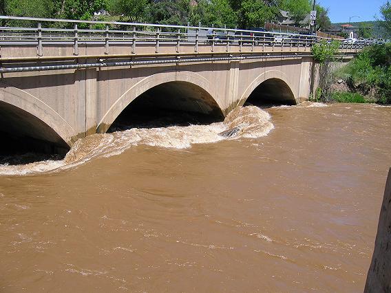
There are two center supports where the Main Ave. bridge crosses the Animas. There was enough current in the river to form impressive bow waves where they intercepted the current. There is also a large log wedged against the distant support that adds to the turbulence in the river.
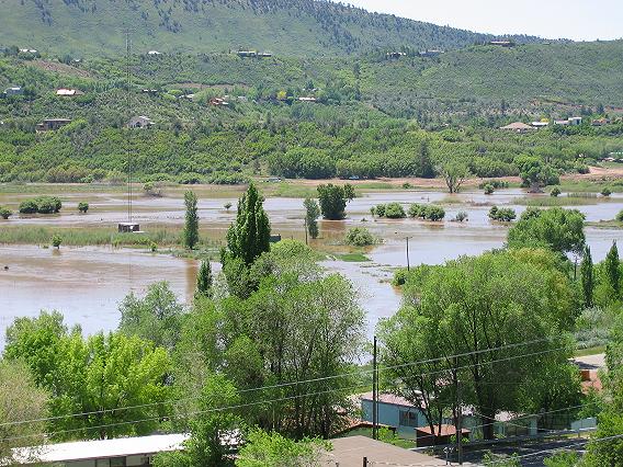
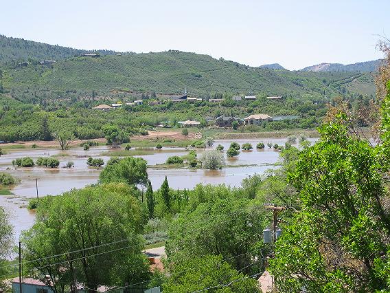
The next set of pictures gives a left to right panorama (view to the east-northeast through south) as seen from U. S. Highway 550 just north of Durango. Most of the time, this area is dry fields and meadows. Also, a land developer had been gung ho about putting in a large development here. (The plan was shot down – or maybe I should say “torpedoed”.)
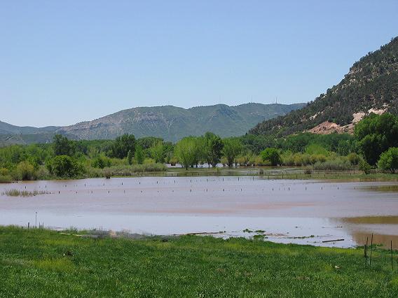
The picture below is a view from north of Durango toward the south-southwest with Smelter Mountain in the distance. Normally this is ranchland that is populated by horses. On this day in May 2005, the horses might find the meadows to be “a little damp”.

One of the enjoyable features of Durango is its Animas River Trail. The trail winds along the river where you can walk, rest under the Cottonwood trees, or just relax. Today parts of the trail are closed.
Here we can see where the trail normally continues under westbound U. S. Highway 160.
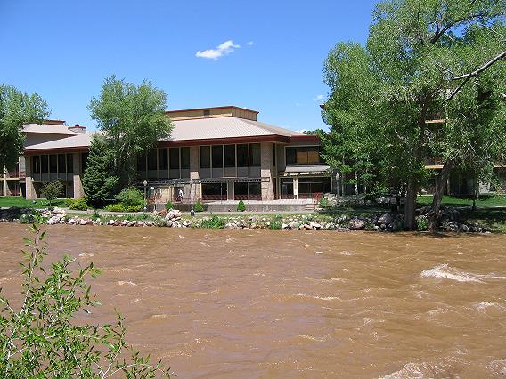
One of Durango’s finer hotels is the Doubletree. You can sit in the dining room and look out over the river. The hotel is high enough so that it will stay above this flood, but it’s getting a little close. . The Animas River Trail is just above river level in front of the hotel.
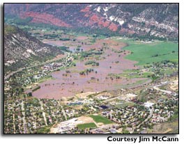
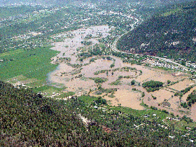
Aerial photographs of the Animas Valley to the north of Durango courtesy of Jim McCann. The left photo is a view looking north while the right photo shows the same area but looking south.
Return to Durango Bill’s home page
Web page generated via Sea Monkey's Composer
within a Linux Cinnamon Mint 18 operating system.
(Goodbye Microsoft)